


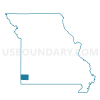
Granby Voting District, Newton County, Missouri
About
Outline

Summary
| Unique Area Identifier | 609231 |
| Name | Granby Voting District |
| County | Newton County |
| State | Missouri |
| Area (square miles) | 50.00 |
| Land Area (square miles) | 49.79 |
| Water Area (square miles) | 0.20 |
| % of Land Area | 99.59 |
| % of Water Area | 0.41 |
| Latitude of the Internal Point | 36.90431170 |
| Longtitude of the Internal Point | -94.26043890 |
Maps


Graphs
Select a template below for downloading or customizing gragh for Granby Voting District, Newton County, Missouri


Neighbors
Neighoring Voting District (by Name) Neighboring Voting District on the Map
- Crowder Voting District, Newton County, MO
- Diamond Voting District, Newton County, MO
- East Neosho Voting District, Newton County, MO
- Newtonia Voting District, Newton County, MO
- Ritchey Voting District, Newton County, MO
- Stella Voting District, Newton County, MO
Top 10 Neighboring County Subdivision (by Population) Neighboring County Subdivision on the Map
- Neosho township, Newton County, MO (18,039)
- Granby township, Newton County, MO (4,595)
- Marion township, Newton County, MO (3,787)
- Franklin township, Newton County, MO (1,795)
- Van Buren township, Newton County, MO (1,374)
- Newtonia township, Newton County, MO (788)
- Benton township, Newton County, MO (681)
Top 10 Neighboring Place (by Population) Neighboring Place on the Map
Top 10 Neighboring Unified School District (by Population) Neighboring Unified School District on the Map
- Neosho R-5 School District, MO (26,125)
- East Newton County R-VI School District, MO (8,895)
- Diamond R-IV School District, MO (5,638)
Top 10 Neighboring State Legislative District Lower Chamber (by Population) Neighboring State Legislative District Lower Chamber on the Map
Top 10 Neighboring State Legislative District Upper Chamber (by Population) Neighboring State Legislative District Upper Chamber on the Map
Top 10 Neighboring 111th Congressional District (by Population) Neighboring 111th Congressional District on the Map
Top 10 Neighboring Census Tract (by Population) Neighboring Census Tract on the Map
- Census Tract 204, Newton County, MO (7,401)
- Census Tract 202, Newton County, MO (4,813)
- Census Tract 209, Newton County, MO (4,526)
- Census Tract 203, Newton County, MO (3,328)